
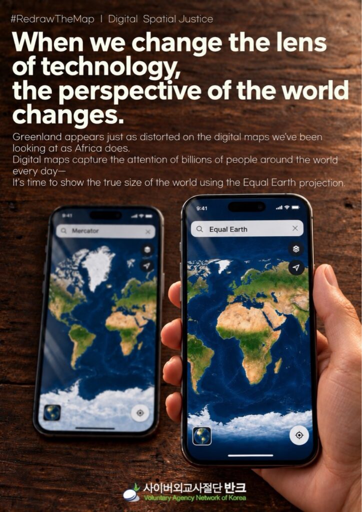
On October 1, 2026, VANK announced that it is proposing that global Big Tech companies improve their digital map platforms to more accurately reflect the relative areas of the continents.
VANK is conducting a campaign (#RedrawTheMap) advocating for the priority use of world maps based on equal-area projection methods, such as “Equal Earth,” which the UN General Assembly has recommended for use.
While the campaign previously targeted global climate and environmental data platforms, it has now been expanded to include digital mapping services—such as Google Maps, Apple Maps, and Microsoft (MS) Bing Maps—and their underlying technologies.
On world maps using the commonly employed Mercator projection, areas are significantly magnified as you move toward higher latitudes, making Greenland, Canada, Russia, and Europe appear larger than they actually are, while the African continent, which is closer to the equator, appears smaller.
When VANK examined the map services of global big tech companies, it found that these companies’ digital map platforms widely used flat maps that did not accurately represent area, even on screens showing the entire world.
In some cases, flat maps were not provided at all, limiting users’ options to 3D globes.
Even in open-source mapping technologies such as “OpenStreetMap,” which are used to create various digital maps, cartographic methods that do not accurately reflect area have been widely used.
In response, VANK proposed that global digital map platforms prioritize the use of mapping methods that more accurately depict the relative areas of continents on screens showing the entire world.
It was decided to actively adopt methods that better convey the actual areas of the world—such as the Equal Earth projection and other equal-area projections—and, in cases where non-equal-area projections must be maintained due to the nature of existing systems or services, to clearly inform users that the maps in question do not accurately represent actual area relationships.
Last month, the UN General Assembly adopted a resolution encouraging governments, educational institutions, international organizations, and technology companies to use equidistant projection methods—such as Equal Earth—on maps where area comparisons between continents and countries are important, to ensure that area ratios are accurately displayed.
Jeon Hye-rin, a youth researcher at VANK who planned this campaign, said, “The focus of this survey was not to criticize specific map services or call for the elimination of certain mapping methods, but rather to ask the question, ‘What kind of map are we looking at when we view the entire world?’” She added, “Since many people today learn about the world’s appearance and the sizes of continents through smartphones and digital map services, it is necessary to examine how the relative areas of each region are represented on screens that display the entire world,” she added.
Park Gi-tae, head of VANK, pointed out the need for improvement, stating, “Today, the spaces where global citizens first encounter world maps are not limited to paper maps hanging on classroom walls but also include smartphones, search engines, and digital map platforms.” He added, “The screens provided by global technology companies and map platforms can influence how countless citizens understand the size of the world and its spatial relationships.”
VANK plans to share the results of its survey and recommendations for improvement with global mapping services and open-source mapping communities, and will continue to monitor the responses and technical discussions from each platform.
In addition, through the “#RedrawTheMap” campaign, VANK plans to create content that helps people easily understand the limitations of map representations and projection methods used to depict the entire world, as well as guidelines for map visualization. The organization also plans to expand the campaign so that global citizens can understand mapping techniques and compare them for themselves.