
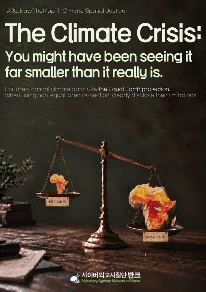
VANK said Sept. 17, 2026, that it is launching the “#RedrawTheMap” campaign urging global climate and environmental data platforms, international organizations and environmental groups to prioritize the use of equal-area world maps such as Equal Earth, whose use was recommended by the U.N. General Assembly.
VANK has formally proposed three practical guidelines for climate crisis maps to 10 leading global climate platforms and international organizations, including the World Resources Institute (WRI), World Bank (WB), U.N. Environment Programme (UNEP) and Global Forest Watch (GFW).
The three guidelines are: ▲ prioritize equal-area projections when visualizing data in which area itself is a key piece of information, such as data on global forest loss and restoration; ▲ when non-equal-area projections such as the Mercator projection must continue to be used, clearly indicate that the map distorts the area of high- and low-latitude regions and that the sizes shown on the map may differ from the actual areas of the land surface; and ▲ institutions and media outlets that cite or publish infographics or maps produced by outside organizations should establish their own standards for cross-checking whether the projection used is appropriate for the nature of the data being presented.
VANK launched the campaign out of concern that non-equal-area projections such as the Mercator projection can distort perceptions of the severity of the climate crisis.
The Mercator world map, which has been widely used, makes land areas appear increasingly larger at higher latitudes, making Greenland, Canada, Russia and Europe appear larger than they actually are. By contrast, Africa and other continents closer to the equator and in the Southern Hemisphere appear smaller.
VANK believes such distortions can directly affect how people perceive the places where the climate crisis is unfolding.
This can create a distorted perception in which low-latitude regions near the equator, including Africa, the Amazon and Southeast Asia, which face severe drought, desertification and large-scale forest loss, appear smaller, while high-latitude regions appear larger.
VANK’s research found that many international organizations, research institutions and data platforms focused on climate and the environment either use Mercator world maps or cite distorted maps from outside sources without modification.
Even when the data themselves are accurate, displaying them on a map with distorted land areas can lead users to mistake the size of a colored area on the map for the actual area of the land surface.
On Sept. 4, 2026, the U.N. General Assembly adopted a resolution encouraging governments, educational institutions, international organizations and technology companies to use Equal Earth and other equal-area projections on maps where accurate comparisons of the areas of continents and countries are important.
Jeon Hye-rin, a VANK youth researcher who planned the campaign, said, “What stood out in this study was not simply the choice of map projection by a particular institution, but the question of from what distorted perspective we are viewing a climate crisis in which area itself is data.”
She added, “We are not calling for every map to be changed across the board. We are making the common-sense proposal that equal-area projections should be prioritized when dealing with data in which area is important and, when a non-equal-area projection must be used, at the very least, an explanatory notice should be provided to alert users to the possibility of distortion.”
Park Gi-tae, head of VANK, said, “The climate crisis is a challenge that can be addressed only when people around the world accurately understand its objective scale and work together.”
“If a world map is being used to show the scale of a crisis, it should also accurately convey the physical extent of the areas where it is unfolding,” he said. “If international organizations, global climate platforms, media outlets and companies adopt these guidelines, it could mark a major turning point in helping people around the world see the climate crisis clearly and without distortion.”
VANK said it plans to make public the official responses from organizations and examples of improvements made to their maps as part of the campaign.